Category:Photographs by WashuOtaku
Photography by WashuOtaku.
Media in category "Photographs by WashuOtaku"
The following 200 files are in this category, out of 461 total.
(previous page) (next page)
 010318-149 Mount Mitchell.JPG 1,037 × 1,565; 1.69 MB
 25th Street Mosaic.jpg 3,648 × 2,736; 2.02 MB
 25th Street Station 01.jpg 3,648 × 2,736; 1.95 MB
 25th Street Station 02.jpg 3,648 × 2,736; 2 MB
 36th Street Station 01.jpg 3,648 × 2,736; 2.1 MB
 36th Street Station 02.jpg 3,648 × 2,736; 2.62 MB
 36th Street Station 03.jpg 3,648 × 2,736; 2.35 MB
 36th Street Station 04.jpg 3,648 × 2,736; 1.92 MB
 36th Street Station 05.jpg 3,648 × 2,736; 1.79 MB
 36th Street Station Sunset.jpg 3,648 × 2,736; 2.06 MB
 9th Street Station 01.jpg 3,648 × 2,736; 2.4 MB
 9th Street Station 02.jpg 2,736 × 3,648; 1.98 MB
 9th Street Station 03.jpg 3,648 × 2,736; 2.05 MB
 Alamance Co I-85N Rest Area-01.jpg 3,648 × 2,736; 2.45 MB
 Alamance Co I-85N Rest Area-02.jpg 3,648 × 2,736; 4.22 MB
 Angola Travel Plaza-01.jpg 5,520 × 3,684; 5.48 MB
 Angola Travel Plaza-02.jpg 5,520 × 3,684; 5.93 MB
 Angola Travel Plaza-03.jpg 3,684 × 5,520; 2.97 MB
 Angola Travel Plaza-04.jpg 5,520 × 3,684; 6.28 MB
 Angola Travel Plaza-05.jpg 5,520 × 3,684; 5.31 MB
 Angola Travel Plaza-06.jpg 5,520 × 3,684; 3.62 MB
 Angola Travel Plaza-07.jpg 5,520 × 3,684; 4.06 MB
 Angola Travel Plaza-08.jpg 5,520 × 3,684; 3.89 MB
 Angola Travel Plaza-09.jpg 5,520 × 3,684; 3.16 MB
 Angola Travel Plaza-10.jpg 5,520 × 3,684; 5.9 MB
 Angola Travel Plaza-11.jpg 5,520 × 3,684; 5.65 MB
 Angola Travel Plaza-12.jpg 5,520 × 3,684; 5.8 MB
 Avery County Courthouse in Newland.jpg 4,288 × 2,848; 2.96 MB
 Avery County Historical Museum.JPG 4,288 × 2,848; 2.97 MB
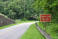
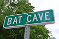 Bat Cave Sign.JPG 4,288 × 2,848; 3.01 MB
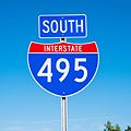
 Begin I-495 Knightdale-01.jpg 5,520 × 3,684; 11.72 MB
 Begin I-495 Knightdale-02.jpg 3,684 × 5,520; 16.99 MB
 Begin I-495 Knightdale-03.jpg 5,520 × 3,684; 13.81 MB
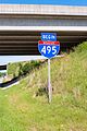
 Begin I-495 Raleigh.jpg 5,520 × 3,684; 14.32 MB
 Bennett Place-Old Hillsboro Road.jpg 7,360 × 4,912; 9.24 MB
 Boone Mall Old Sign.jpg 2,736 × 3,648; 2.29 MB
 Bridge of North Toe River in Newland.jpg 4,288 × 2,848; 3.07 MB
 Buck Creek Gap-2014.jpg 5,520 × 3,684; 5.35 MB
 Bull Gap-2011.jpg 4,288 × 2,848; 2.92 MB
 Carlisle SC Highways.jpg 5,520 × 3,684; 6.46 MB
 Charleston Co I-26E Rest Area-01.jpg 5,520 × 3,684; 16.49 MB
 Charleston Co I-26E Rest Area-02.jpg 5,520 × 3,684; 15.37 MB
 Charleston Co I-26E Rest Area-03.jpg 10,905 × 3,684; 30.56 MB
 Charleston Co I-26E Rest Area-04.jpg 3,943 × 5,520; 17.53 MB
 Charleston Co I-26E Rest Area-05.jpg 5,520 × 3,684; 19.6 MB
 Charleston Co I-26E Rest Area-06.jpg 5,520 × 3,684; 17.15 MB
 Charleston Co I-26E Rest Area-07.jpg 5,520 × 3,684; 17.42 MB
 Charleston Co I-26E Rest Area-08.jpg 5,520 × 3,684; 17.08 MB
 Charleston Co I-26E Rest Area-09.jpg 5,520 × 3,684; 18.8 MB
 Charleston Co I-26E Rest Area-10.jpg 5,520 × 3,684; 17.4 MB
 Charleston Co I-26E Rest Area-11.jpg 5,520 × 3,105; 14.36 MB
 Charleston Co I-26E Rest Area-12.jpg 10,855 × 3,684; 32.68 MB
 Charleston Co I-26E Rest Area-13.jpg 3,684 × 5,520; 12.22 MB
 Charleston Co I-26E Rest Area-14.jpg 5,520 × 3,684; 17.66 MB
 Chester Co I-77N Rest Area-01.jpg 5,520 × 3,684; 14.99 MB
 Chester Co I-77N Rest Area-02.jpg 5,520 × 3,684; 13.78 MB
 Chester Co I-77N Rest Area-03.jpg 5,520 × 3,684; 14.37 MB
 Chester Co I-77N Rest Area-04.jpg 12,732 × 3,684; 39.14 MB
 Chester Co I-77N Rest Area-05.jpg 12,414 × 3,684; 33.95 MB
 Chester Co I-77N Rest Area-06.jpg 3,684 × 5,520; 17.42 MB
 Chester Co I-77N Rest Area-07.jpg 5,520 × 3,684; 18.12 MB
 Chester Co I-77N Rest Area-08.jpg 5,520 × 3,684; 19.84 MB
 Chester Co I-77N Rest Area-09.jpg 5,520 × 3,684; 18.76 MB
 Chester Co I-77N Rest Area-10.jpg 5,520 × 3,684; 19.57 MB
 Chester Co I-77N Rest Area-11.jpg 5,520 × 3,684; 16.01 MB
 Chester Co I-77N Rest Area-12.jpg 5,520 × 3,684; 16.64 MB
 Chester Co I-77N Rest Area-13.jpg 5,520 × 3,684; 15.57 MB
 Chester Co I-77N Rest Area-14.jpg 5,520 × 3,684; 20.85 MB
 Chester Co I-77N Rest Area-15.jpg 5,520 × 3,684; 13.78 MB
 Clifton L Benson Highway.JPG 2,736 × 3,648; 3.16 MB
 Craven Gap-2011.jpg 4,288 × 2,848; 2.98 MB
 Davidson Co I-85N Rest Area-01.jpg 7,360 × 4,912; 9.21 MB
 Davidson Co I-85N Rest Area-02.jpg 4,912 × 7,360; 8.89 MB
 Davidson Co I-85S Rest Area-01.jpg 7,360 × 4,912; 9.18 MB
 Davidson Co I-85S Rest Area-02.jpg 4,912 × 7,360; 8.74 MB
 Davidson Co I-85S Rest Area-03.jpg 7,360 × 4,912; 9.41 MB
 Davidson Co I-85S Rest Area-04.jpg 4,912 × 7,360; 9.19 MB
 Deals Gap-Welcome to NC.jpg 5,520 × 3,684; 8.05 MB
 Dr Mary Martin Sloop Highway.jpg 3,648 × 2,736; 4.45 MB
 Durham--Gregson Street Guillotine 01.jpg 5,520 × 3,105; 11.89 MB
 Durham--Gregson Street Guillotine 02.jpg 5,520 × 3,684; 15.84 MB
 Durham--Gregson Street Guillotine 03.jpg 5,520 × 3,684; 15.06 MB
 Durham--Norfolk Southern-Neal Road Overpass.jpg 5,520 × 3,684; 15.01 MB
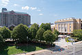 Durham-ConCenter-Marriott-Theatre.jpg 5,520 × 3,684; 12.19 MB
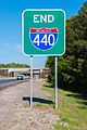 East I-440 End-Raleigh.jpg 3,684 × 5,520; 5.79 MB
 East NC 275 Gastonia.jpg 5,520 × 3,684; 5.38 MB
 End I-495 & US 264 Raleigh.jpg 5,520 × 3,105; 11.53 MB
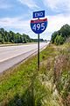 End I-495 Knightdale.jpg 3,684 × 5,520; 18.41 MB
 Exit 101 Northbound I-77.jpg 7,305 × 4,109; 22 MB
 Exit 101 Southbound I-77.jpg 5,520 × 3,105; 14.11 MB
 Fish Dam Battle Ground Monument.jpg 5,520 × 3,684; 6.12 MB
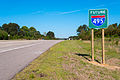 Future I-495-Knightdale.jpg 5,520 × 3,684; 6.94 MB
 Gorges State Park 01.jpg 5,520 × 3,684; 5.23 MB
 Gorges State Park 02.jpg 5,520 × 3,684; 4.95 MB
 Gorges State Park 03.jpg 3,684 × 5,520; 5.21 MB
 Gorges State Park 04.jpg 3,684 × 5,520; 5.12 MB
 Gorges State Park 05.jpg 5,520 × 3,684; 8.82 MB
 Gorges State Park 06.jpg 3,684 × 5,520; 4.96 MB
 Gorges State Park 07.jpg 5,520 × 3,684; 4.49 MB
 Gorges State Park 08.jpg 3,684 × 5,520; 4.78 MB
 Gorges State Park 09.jpg 5,520 × 3,684; 5.62 MB
 Gorges State Park 10.jpg 5,520 × 3,684; 7.35 MB
 Gorges State Park 11.jpg 5,520 × 3,684; 10.07 MB
 Gorges State Park 12.jpg 5,520 × 3,684; 8.68 MB
 Grandfather and Pixie Mountains.jpg 4,288 × 2,848; 3 MB
 Grandmother Mountain, from atop Grandfather Mountain.jpg 4,288 × 2,848; 2.77 MB
 Halcyon Idyll I.jpg 3,648 × 2,736; 2.53 MB
 Halcyon Idyll II.jpg 3,648 × 2,736; 2.67 MB
 Hamby Creek-01.jpg 4,912 × 7,360; 9.27 MB
 Hamby Creek-02.jpg 7,360 × 4,912; 9.28 MB
 Harvey B. Gantt Center on Opening Day.jpg 4,288 × 2,848; 3.01 MB
 I-440 Exit 14 Gantry.jpg 5,520 × 3,684; 14.81 MB
 I-495 South and US 264 West End.jpg 5,520 × 3,684; 14.83 MB
 I-495 South Knightdale.jpg 4,912 × 4,912; 5.32 MB
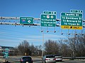
.jpg/120px-I-495_US_64_US_264_Raleigh_(2014).jpg) I-495 US 64 US 264 Raleigh (2014).jpg 5,520 × 3,684; 9.68 MB
I-495 US 64 US 264 Raleigh (2014).jpg 5,520 × 3,684; 9.68 MB
.jpg/120px-I-495_US_64_US_264_Raleigh_(2016).jpg) I-495 US 64 US 264 Raleigh (2016).jpg 5,520 × 3,684; 17.49 MB
I-495 US 64 US 264 Raleigh (2016).jpg 5,520 × 3,684; 17.49 MB
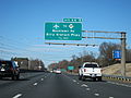
 I-540 Exit 26B Gantry.jpg 5,520 × 3,684; 10.47 MB
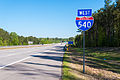 I-540 West-Knightdale.jpg 5,520 × 3,684; 5.29 MB
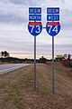
 I-73 I-74 Tabernacle Church Road.jpg 5,441 × 2,481; 3.13 MB
 I-74WB&I-77NB NC Weigh Station-01.jpg 7,308 × 4,111; 16.65 MB
 I-74WB&I-77NB NC Weigh Station-02.jpg 7,308 × 4,111; 16.03 MB
 I-77-US21-Woodlawn-BillyGraham-OverheadSign.jpg 3,648 × 2,736; 1.71 MB
 I277-nc16-BrookshireFreeway-OverheadSign.jpg 3,648 × 2,736; 2.14 MB
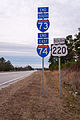
 I73-I74Begin-Ellerbe.jpg 3,684 × 5,520; 5.32 MB
 I73-I74End-Ellerbe.jpg 3,684 × 5,520; 4.33 MB
 Iredell Co I-77N Rest Area-01.jpg 5,520 × 3,684; 12.11 MB
 Iredell Co I-77N Rest Area-02.jpg 5,520 × 3,684; 15.33 MB
 Iredell Co I-77N Rest Area-03.jpg 5,520 × 3,684; 15.48 MB
 Iredell Co I-77N Rest Area-04.jpg 5,520 × 3,684; 17.59 MB
 Iredell Co I-77N Rest Area-05.jpg 5,520 × 3,684; 17.16 MB
 Iredell Co I-77N Rest Area-06.jpg 5,520 × 3,684; 19.69 MB
 Iredell Co I-77N Rest Area-07.jpg 5,520 × 3,684; 20.5 MB
 Iredell Co I-77N Rest Area-08.jpg 5,520 × 3,684; 20.2 MB
 Iredell Co I-77N Rest Area-09.jpg 12,320 × 3,684; 29.42 MB
 Iredell Co I-77N Rest Area-10.jpg 5,520 × 3,684; 16.18 MB
 Iredell Co I-77N Rest Area-11.jpg 5,520 × 3,684; 18.18 MB
 Iredell Co I-77N Rest Area-12.jpg 5,520 × 3,684; 12.51 MB
 Iredell Co I-77S Rest Area-01.jpg 7,260 × 4,845; 21.49 MB
 Iredell Co I-77S Rest Area-02.jpg 7,360 × 4,912; 27.69 MB
 Iredell Co I-77S Rest Area-03.jpg 7,260 × 4,845; 26.69 MB
 Iredell Co I-77S Rest Area-04.jpg 7,360 × 4,912; 29.2 MB
 Iredell Co I-77S Rest Area-05.jpg 7,360 × 4,912; 25.11 MB
 Iredell Co I-77S Rest Area-06.jpg 7,360 × 4,912; 32.13 MB
 Iredell Co I-77S Rest Area-07.jpg 7,360 × 4,912; 25.26 MB
 Iredell Co I-77S Rest Area-08.jpg 13,698 × 3,684; 41.86 MB
 Iredell Co I-77S Rest Area-09.jpg 7,360 × 4,912; 26.96 MB
 Iredell Co I-77S Rest Area-10.jpg 4,912 × 7,360; 22.07 MB
 Iredell Co I-77S Rest Area-11.jpg 7,360 × 4,912; 31.47 MB
 Iredell Co I-77S Rest Area-12.jpg 4,811 × 7,208; 26.54 MB
 Iredell Co I-77S Rest Area-13.jpg 19,048 × 3,684; 65.91 MB
 Iredell Co I-77S Rest Area-14.jpg 7,360 × 4,912; 32.42 MB
 Iredell Co I-77S Rest Area-15.jpg 7,360 × 4,912; 22.75 MB
 Iredell Co I-77S Rest Area-16.jpg 7,360 × 4,912; 19.57 MB
 Iredell Co I-77S Rest Area-17.jpg 7,360 × 4,912; 18.27 MB
 Iredell Co I-77S Rest Area-18.jpg 7,360 × 4,912; 20.24 MB
 Iredell Co I-77S Rest Area-19.jpg 7,360 × 4,912; 28.88 MB
 Iredell Co I-77S Rest Area-20.jpg 4,912 × 7,360; 21.3 MB
 Iredell Co I-77S Rest Area-21.jpg 7,360 × 4,912; 28.46 MB
 Iredell Co I-77S Rest Area-22.jpg 7,360 × 4,912; 35.01 MB
 Iredell–Yadkin Co I-77N Rest Area-01.jpg 5,520 × 3,684; 13.15 MB
 Iredell–Yadkin Co I-77N Rest Area-02.jpg 5,520 × 3,684; 18.15 MB
 Iredell–Yadkin Co I-77N Rest Area-03.jpg 5,520 × 3,684; 21.09 MB
 Iredell–Yadkin Co I-77N Rest Area-04.jpg 5,520 × 3,684; 18.41 MB
 Iredell–Yadkin Co I-77N Rest Area-05.jpg 5,520 × 3,684; 22.66 MB
 Iredell–Yadkin Co I-77N Rest Area-06.jpg 5,520 × 3,684; 11.15 MB
 Iredell–Yadkin Co I-77N Rest Area-07.jpg 5,520 × 3,684; 21.03 MB
 Iredell–Yadkin Co I-77N Rest Area-08.jpg 5,520 × 3,684; 23.66 MB
 Iredell–Yadkin Co I-77N Rest Area-09.jpg 5,520 × 3,684; 22.44 MB
 Iredell–Yadkin Co I-77N Rest Area-10.jpg 5,520 × 3,684; 14.05 MB
 Iredell–Yadkin Co I-77N Rest Area-11.jpg 8,415 × 3,684; 27.08 MB
 Iredell–Yadkin Co I-77N Rest Area-12.jpg 5,520 × 3,684; 19.8 MB
 Iredell–Yadkin Co I-77N Rest Area-13.jpg 15,826 × 3,684; 49.56 MB
 Iredell–Yadkin Co I-77N Rest Area-14.jpg 5,520 × 3,684; 19.19 MB
 Iredell–Yadkin Co I-77N Rest Area-15.jpg 5,520 × 3,684; 21.39 MB
 Iredell–Yadkin Co I-77N Rest Area-16.jpg 3,684 × 5,520; 14.73 MB
 Iredell–Yadkin Co I-77S Rest Area-01.jpg 5,520 × 3,684; 16.05 MB
 Iredell–Yadkin Co I-77S Rest Area-02.jpg 5,520 × 3,684; 15.7 MB
 Iredell–Yadkin Co I-77S Rest Area-03.jpg 5,520 × 3,684; 18.92 MB
 Iredell–Yadkin Co I-77S Rest Area-04.jpg 5,520 × 3,684; 21.69 MB
 Iredell–Yadkin Co I-77S Rest Area-05.jpg 12,481 × 3,684; 39.72 MB
 Iredell–Yadkin Co I-77S Rest Area-06.jpg 5,520 × 3,684; 17.58 MB
 Iredell–Yadkin Co I-77S Rest Area-07.jpg 5,520 × 3,684; 19.63 MB
 Iredell–Yadkin Co I-77S Rest Area-08.jpg 11,490 × 3,684; 40.34 MB
 Iredell–Yadkin Co I-77S Rest Area-09.jpg 5,520 × 3,684; 19.81 MB
 Iredell–Yadkin Co I-77S Rest Area-10.jpg 3,684 × 5,520; 14.29 MB
 Iredell–Yadkin Co I-77S Rest Area-11.jpg 5,520 × 3,684; 15.11 MB
 Iredell–Yadkin Co I-77S Rest Area-12.jpg 5,520 × 3,684; 11.62 MB
 Iredell–Yadkin Co I-77S Rest Area-13.jpg 5,520 × 3,684; 17.11 MB
 JW Clay Blvd Station 01.jpg 3,648 × 2,736; 2.46 MB
 JW Clay Blvd Station 02.jpg 3,648 × 2,736; 2.88 MB
 JW Clay Blvd Station 03.jpg 3,648 × 2,736; 3.13 MB
 JW Clay Blvd Station 04.jpg 2,736 × 3,648; 1.85 MB
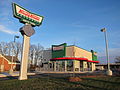 Krispy Kreme-Burlington NC.jpg 3,648 × 2,736; 2.32 MB
 Lake View Drive-Tuckasegee River.jpg 5,520 × 3,684; 7.58 MB
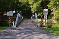
 Lakeview Drive Entrance Sign.jpg 5,520 × 3,684; 6.87 MB
.jpg/120px-Lakeview_Drive_Tunnel_(Back).jpg) Lakeview Drive Tunnel (Back).jpg 5,520 × 3,684; 7.31 MB
Lakeview Drive Tunnel (Back).jpg 5,520 × 3,684; 7.31 MB
.jpg/120px-Lakeview_Drive_Tunnel_(Front).jpg) Lakeview Drive Tunnel (Front).jpg 5,520 × 3,684; 9.07 MB
Lakeview Drive Tunnel (Front).jpg 5,520 × 3,684; 9.07 MB
 Lakeview Drive West Entrance Sign.jpg 5,520 × 3,684; 7.68 MB
 Lakeview Drive-Dead End.jpg 5,520 × 3,684; 8.44 MB
 Lakeview Drive-Fontana Dam.jpg 5,520 × 3,684; 4.92 MB